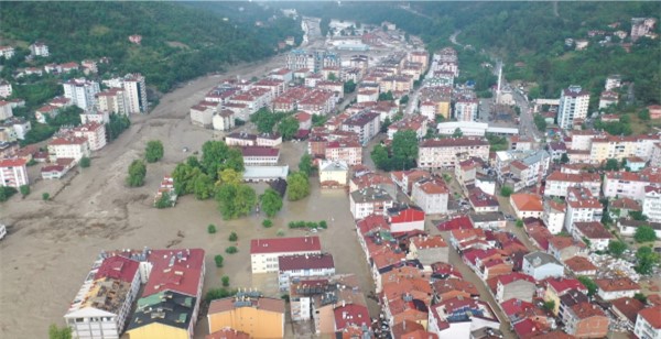
As in many countries of the world, flood events, which have become increasingly common in our country, especially in the last 15-20 years, cause both loss of life and property. Although natural disasters, the effects of which we have felt more in recent years, are closely related to the physical factors of climate, geomorphological features, vegetation, etc., they are also directly related to the increasing population, unplanned urbanization, economic and human activities in river basins. It is also possible to say that meteorological disasters, such as floods, have a more destructive effect due to the changing climate conditions in recent times, and these disasters occur more frequently.
Although the main factor of floods is known to be rainfall, the gradual destruction of the natural features of river basins, intensive land use and wrong interventions in river beds cause floods even with normal rainfall. In addition, engineering structures built on rivers sometimes cause features that were not risky before to be evaluated as risks. This causes some new plans to be taken into consideration in risk management studies for land uses along the river bed.
Risk management, which is a systematic process, consists of risk identification, risk analysis and risk quantification. The work that needs to be done to minimize the loss of life and property in a possible flood and to reduce the negative effects of the flood can be carried out through risk management in flood areas. In risk management studies, hazards and risks are determined, risk scenarios are prepared, protection and mitigation measures are selected, the results are presented with up-to-date maps and graphics, resources and opportunities that can be used are determined, decisions about the most appropriate options and priorities for disaster protection and disaster response are made and implemented.
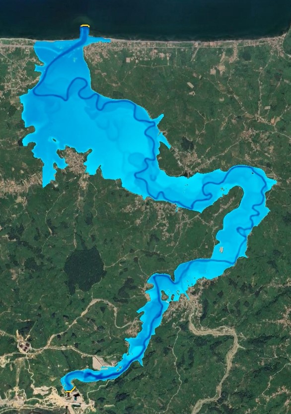
Melen Stream 2D Flood Analysis